No edit summary |
|||
| (18 intermediate revisions by 3 users not shown) | |||
| Line 1: | Line 1: | ||
__NOTOC__ | |||
In this page you can find a summary of the feature of the MSP Challenge Simulation Platform and the several ways you can use it. | |||
The platform has a client-server architecture. We first explain the main features of the client software, then we explain key functionalities / interfaces of the server. | |||
== Client == | |||
=== Analyze various data layers === | |||
Get an idea of the current status in a sea basin by reviewing real geodata obtained through GIS sources such as EMODnet and Copernicus. Find more information through our [https://knowledge.mspchallenge.info Knowledge Base]. | |||
[[File:ImageAnalyseDataLayers.png|border|800x800px]] | |||
=== Explore potential consequences === | |||
See the positive and negative impacts (in a system dynamics sense) between different aspects, e.g. an increase in noise (a 'positive' effect) or a decrease in fishing (a 'negative' effect) resulting from a wind farm. | |||
[[File:ImageExploreConsequences.png|border|800x800px]] | |||
| | |||
=== Change or draw up new spatial plans === | |||
Besides or instead of existing plans and activities in the marine region. [[Restriction|Restrictions]] can be set to provide feedback on overlapping types of geometry, and block or warn the user from performing undesired actions. '''Plans''' developed and implemented by the users generate layer type dependent levels of '''impact''' on the '''simulation''' models. Every change matters and '''alters''' the state of the '''sea basin''', be it on the ecology, ship intensity, or energy production. | |||
[[File:ImageDrawPlans.png|border|800x800px]] | |||
=== Share and collaborate === | |||
=== | Define and refine your spatial plans before implementing them. Players must '''communicate''' to keep their sea basin in optimal shape while communally improving on human activities. | ||
[[File:ImageShareCollaborate.png|border|800x800px]] | |||
=== Simulate and evaluate === | |||
Plans impact '''cross-boundary''' shipping and ecology, capable of disrupting an entire sea basin | Three (or more) simulations calculating e.g. '''Ship Traffic, Energy Production Capacity,''' and '''Ecosystem Dynamics''' can be connected to the sea basins, measuring cumulative impacts throughout the area. Models calculate the latest state every '''month''' of '''in-game time''', creating a continuous simulation of the current state of the sea basin. Plans impact '''cross-boundary''' shipping and ecology, capable of disrupting an entire sea basin. | ||
| | [[File:ImageSimulateEvaluate.png|border|800x800px]] | ||
=== | === Dig deeper and try again === | ||
KPIs provide insight in the core values representing '''Shipping''', '''Ecology,''' and '''Energy''' to gain insight in the constantly changing state of the sea basin. Use the objectives monitor to '''compare indicators''' with the '''plans''' created through the game session, and to view the '''objectives''' set for all teams in the game session. Impacts not exactly what you were looking for? Then try again, make new plans! | |||
! | |||
[[File:ImageDigDeeperTryAgain.png|border|800x800px]] | |||
==Server== | |||
=== '''Integrate and review dozens of data layers''' === | |||
From relevant external GIS sources such as EMODnet or Copernicus. | |||
{| width="100%" | {| width="100%" | ||
|- class="header" | |- class="header" | ||
! width="50%" | | ! width="50%" align="left" |Geoserver | ||
! width="50%" | | ! | ||
! width="50%" align="left" |Layers | |||
|- | |- | ||
| class="content separator" valign="top" |[[File: | | class="content separator" valign="top" |[[File:Geoserver.png|frameless]] | ||
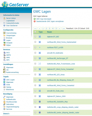
The MSP Challenge Simulation Platform utilizes a '''GeoServer''' to '''manage''' all '''GeoData''' retrieved from official GIS sources. The MSP Geoserver can be used, however, it is also possible to set up your own GeoServer for self-distributed data. | |||
| | |||
| class="content separator" valign="top" |[[File:ImageDatalayers.png|frameless]]<br /> | |||
'''Data layers''' are the core content of the MSP Challenge Simulation Platform, allowing users to '''interact''' with the '''environment''' as desired. These layers can be controlled via configurations, and '''interacted''' with via the MSP Challenge '''Client'''. | |||
|} | |||
|} | |||
=== | === Server Manager === | ||
To add or remove sessions, simultaneously control and gain insight from multiple sessions and determine the duration of a session. | |||
{| width="100%" | {| width="100%" | ||
|- class="header" | |- class="header" | ||
! width="50%" | | ! width="50%" align="left" |Server Browser | ||
! width="50%" | | ! | ||
! width="50%" align="left" |Session Setup | |||
|- | |- | ||
| class="content separator" valign="top" | | | class="content separator" valign="top" |[[File:ImageServerManager.png|frameless|500x500px]] | ||
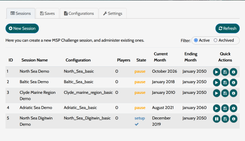
| class="content separator" valign="top" | | Use the server browser to '''view''' all '''active sessions'''. This contains up to date information about the '''state''', as well as info on the setup of the sessions. The server manager allows for '''multiple sessions''' to be active on a single server machine. | ||
| | |||
| class="content separator" valign="top" |[[File:ImageServerManagerAddSession.png|frameless|500x500px]] | |||
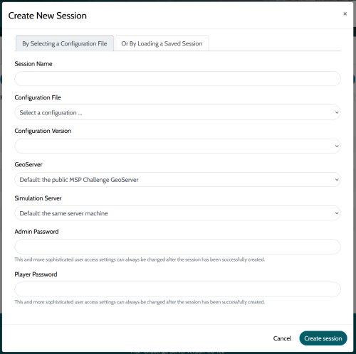
'''New sessions''' can be started via the session manager, allowing the game manager to select '''configurations''' to use, session '''names''', '''passwords''', and many other settings. | |||
|} | |||
|} | |||
=== Configuration control === | |||
As configurations form the base of any session, these can be used to set rules, and manage layers used during the session. | |||
{| width="100%" | {| width="100%" | ||
|- class="header" | |- class="header" | ||
! width="50%" | | ! width="50%" align="left" |Config Editor | ||
! width="50%" | | ! | ||
! width="50%" align="left" |Config Management | |||
|- | |- | ||
| class="content separator" valign="top" | | | class="content separator" valign="top" |The config editor allows game managers to '''customize''' a pre-developed set of '''configurations''' to their own liking. Configurations determine amongst others the active '''layers''', '''interactivity''', '''visualizations''', '''restrictions''', and '''impacts''' on simulation models. | ||
| | |||
| class="content separator" valign="top" | | | class="content separator" valign="top" | | ||
Via the server manager, multiple '''configuration files''' can be '''added''' and '''maintained''', allowing game managers to run multiple sessions with varying configurations, '''updating''' the desired configuration with feedback from every session they manage. | |||
|} | |} | ||
For in-depth information on these features, have a look at our [[Basic features|video tutorials]], or simply [[Download|try out our online demo]].<br />{{Category|name=InProgress}} | |||
Latest revision as of 12:47, 14 June 2023
In this page you can find a summary of the feature of the MSP Challenge Simulation Platform and the several ways you can use it.
The platform has a client-server architecture. We first explain the main features of the client software, then we explain key functionalities / interfaces of the server.
Client
Analyze various data layers
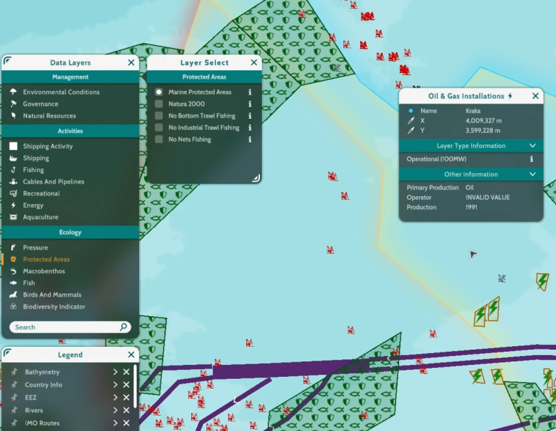
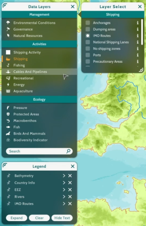
Get an idea of the current status in a sea basin by reviewing real geodata obtained through GIS sources such as EMODnet and Copernicus. Find more information through our Knowledge Base.
Explore potential consequences
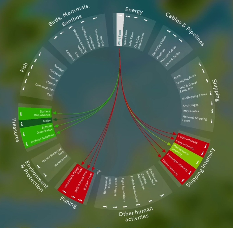
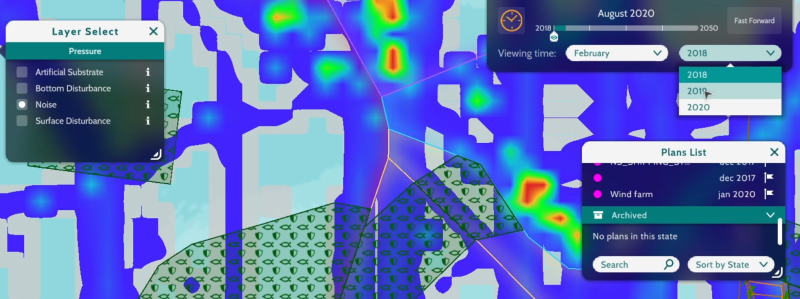
See the positive and negative impacts (in a system dynamics sense) between different aspects, e.g. an increase in noise (a 'positive' effect) or a decrease in fishing (a 'negative' effect) resulting from a wind farm.
Change or draw up new spatial plans
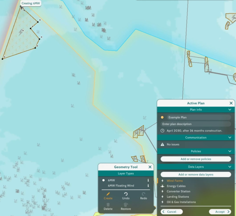
Besides or instead of existing plans and activities in the marine region. Restrictions can be set to provide feedback on overlapping types of geometry, and block or warn the user from performing undesired actions. Plans developed and implemented by the users generate layer type dependent levels of impact on the simulation models. Every change matters and alters the state of the sea basin, be it on the ecology, ship intensity, or energy production.
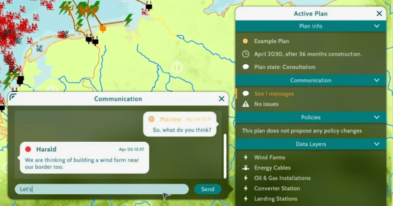
Define and refine your spatial plans before implementing them. Players must communicate to keep their sea basin in optimal shape while communally improving on human activities.
Simulate and evaluate
Three (or more) simulations calculating e.g. Ship Traffic, Energy Production Capacity, and Ecosystem Dynamics can be connected to the sea basins, measuring cumulative impacts throughout the area. Models calculate the latest state every month of in-game time, creating a continuous simulation of the current state of the sea basin. Plans impact cross-boundary shipping and ecology, capable of disrupting an entire sea basin.
Dig deeper and try again
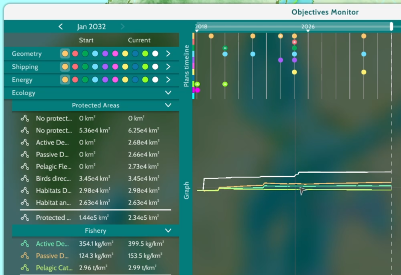
KPIs provide insight in the core values representing Shipping, Ecology, and Energy to gain insight in the constantly changing state of the sea basin. Use the objectives monitor to compare indicators with the plans created through the game session, and to view the objectives set for all teams in the game session. Impacts not exactly what you were looking for? Then try again, make new plans!
Server
Integrate and review dozens of data layers
From relevant external GIS sources such as EMODnet or Copernicus.
Server Manager
To add or remove sessions, simultaneously control and gain insight from multiple sessions and determine the duration of a session.
Configuration control
As configurations form the base of any session, these can be used to set rules, and manage layers used during the session.
| Config Editor | Config Management | |
|---|---|---|
| The config editor allows game managers to customize a pre-developed set of configurations to their own liking. Configurations determine amongst others the active layers, interactivity, visualizations, restrictions, and impacts on simulation models. |
Via the server manager, multiple configuration files can be added and maintained, allowing game managers to run multiple sessions with varying configurations, updating the desired configuration with feedback from every session they manage. |
For in-depth information on these features, have a look at our video tutorials, or simply try out our online demo.
 Co-funded by the European Union.