On this page you can find information on how to learn how the MSP Challenge Simulation Platform works.
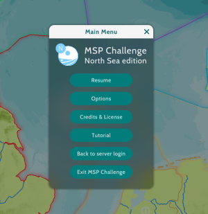
Since version 4.0-RC1, there's a Tutorial mode included in the game software. You can find it by logging on to a session, and then opening up the main menu by clicking on the cog wheel in the top-left corner:
The Tutorial button will activate the tutorial, consisting of the following:
- The basics of navigating over the map and the more general buttons on the left.
- Finding, activating, and understanding all the data layers at your disposal.
- Creating a spatial plan, in which you designate areas for protection and/or certain human activities.
- Analysing consequences of all the spatial plans to e.g. the ecosystem, once the simulations calculating those consequences have actually run.
At the moment our newly developed fisheries managemt features are not included in the tutorial, please refer to the videos below:
- For seasonal fishing bans and buffer zones around marine protected areas
- To control national fleets fishing effort
- To apply a policy to use more ecological fishing gear (to avoid by-catch)
This page was last edited on 24 April 2025, at 20:15. Content is available under GPLv3 unless otherwise noted.


 Co-funded by the European Union.